

Mayo braced for Storm Boelo as strong winds and flooding risks loom
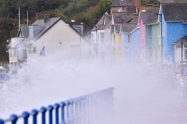

Mayo County Council urges public to avoid coastal areas and unnecessary journeys as damaging winds and heavy rain threaten the bank holiday weekend
Mayo County Council is urging the public to take precautions ahead of Storm Boelo, with multiple weather warnings in place for the county and a risk of flooding, damaging winds and significant travel disruption over the bank holiday weekend.
A Status Yellow Rain Warning will be in effect for Mayo from 4am to 3pm on Saturday, October 24, with heavy spells of rain expected to create difficult driving conditions, localised flooding and possible disruption to outdoor activities.
A Status Orange Wind Warning will follow from 2pm on Saturday until 9am on Sunday, October 25, as Storm Boelo brings gale-force westerly winds and severe, potentially damaging gusts to Mayo and other counties in the west and northwest.
A Status Yellow Wind Warning will also apply from 1pm on Saturday until noon on Sunday, with strong winds expected to continue creating hazardous conditions.
The warnings come as local authorities and emergency management agencies prepare for the arrival of the storm, with the National Severe Weather and Flood Coordination Group continuing to meet to assess the evolving situation.
The National Directorate for Fire and Emergency Management said Storm Boelo is forecast to track to the Northwest of Ireland, bringing very strong winds and intense spells of rain.
With the ground already saturated following recent rainfall, further heavy rain could lead to surface water and river flooding. Small rivers in upland and urban areas are expected to respond quickly, while larger rivers may continue rising even after rainfall eases.
A High Tide Advisory is also in place for Mayo, Galway, Sligo, Leitrim and Donegal from 3pm on Saturday until 7am on Sunday.
Strong onshore winds, high tides, storm surge and large waves could result in coastal flooding and waves overtopping exposed areas. Higher sea levels may also slow the flow of rivers into the sea, increasing the risk of flooding in low-lying estuarine areas.
Potential impacts of the storm include fallen trees and branches, damage to power lines, power outages, damage to homes and businesses, disruption to public transport, dangerous sea conditions and flooding in vulnerable locations.
Mayo County Council said its emergency response crews would remain on standby throughout the weekend, with severe weather assessment teams monitoring conditions and preparing to respond where necessary.
Mayo County Council is advising people to avoid unnecessary journeys during periods of severe weather and to take extra care on roads, particularly in exposed coastal and upland areas.
Members of the public are also being urged to secure loose outdoor items, including bins, garden furniture, trampolines and temporary structures, before Saturday morning.
People should stay away from seafronts, piers, cliffs, coastal walkways and other exposed coastal areas while the warnings are in effect, and keep clear of riverbanks, streams and canals where water levels may rise quickly.
Motorists are being reminded never to drive through floodwater or attempt to cross flooded roads on foot or by bicycle. Drivers should turn back and find another route, allow extra time for essential journeys and never ignore road closure signs, as damage beneath floodwater may not be visible.
The public is also advised to charge mobile phones, keep essential supplies available in case of power outages and check with transport operators before travelling.
Anyone encountering fallen power lines should stay well clear and contact ESB Emergency Services on 1800 372 999. Children and pets should be kept away from waterways and flooded areas.
The Irish Coast Guard’s advice during the storm is clear: “Stay Back, Stay High, Stay Dry.”
The public is urged to keep up to date with the latest forecasts and warnings from Met Éireann and follow advice issued by local authorities and emergency services.
Head of the National Directorate for Fire and Emergency Management Keith Leonard thanked local teams for their work in dealing with the impacts of Storm Austen and said preparations were continuing ahead of the latest storm.
“Of particular concern is the challenge expected from extremely strong winds in the northwest,” he said. “I would advise everyone to avoid coastal areas during the period of the weather warnings and heed all Coast Guard advice. We will also be closely monitoring tidal and river levels throughout the country for flooding dangers and are prepared to act promptly and effectively.”
Further information on weather warnings is available at www.met.ie, while practical advice on preparing for emergencies can be found on the government’s website.