

OPW flood scheme delay cited in planning refusal for west Mayo accommodation units


Planning permission for three tourism accommodation units in Westport refused due to absence of Westport Flood Relief Scheme
A delay by the Office of Public Works in sanctioning the development of the Westport Flood Relief Scheme was given as a reason for refusing planning for three tourism accommodation units in Westport.
Mayo County Council refused planning permission to Linda Turner and Paul Kilkelly to develop three tourism accommodation units at the rear of their property on Distillery Road in Westport citing flooding concerns as a major reason.
The three units were to be located on a site at the rear of St Anthony's Guesthouse which is adjacent to the Carrowbeg River, and within an area identified in CFRAM maps as being a potential future flood hazard and flood risk.
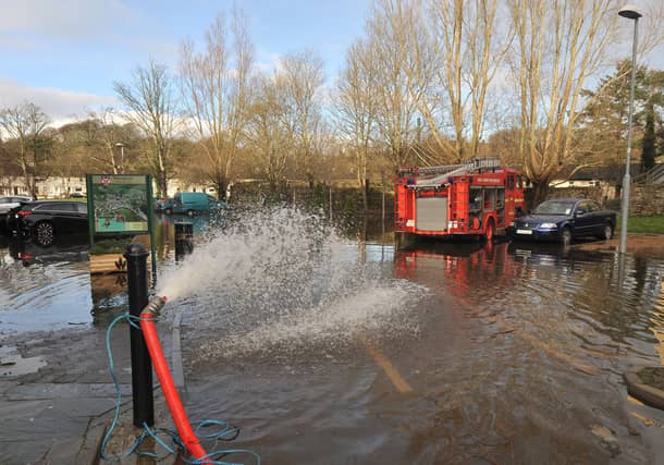
The last major flooding incident in Westport occurred in December 2015 following Storm Desmond when heavy rainfall caused the Carrowbeg river to burst its banks and flood property in two estates along the Ballinrobe Road.
Premature
A flood risk screen assessment was submitted on behalf of the applicants which stated that the property already has an existing high stone wall separating the river from the proposed development site. This the report stated provides an existing flood defense mechanism and recommended modifications such as raising the final floor level of the units to mitigate against flooding.
However despite this Mayo County Council stated that the proposed development 'may increase flood risk in the area' and 'is premature pending the development of the Westport Flood Relief Scheme'.
“The Flood Risk Management team are awaiting approval to proceed to full stage assessment on the Westport Flood Relief Scheme. The OPW are not permitting any more schemes to proceed just yet until a pilot is completed with Donegal [County Council] on advanced data gathering for schemes before consultants are appointed. Thus the proposed development is now considered premature pending the development of the Westport Flood Relief Scheme,” the council's planning report stated.
Three units
The applicants had proposed to demolish two existing sheds on the site and construct three accommodation units. Unit 1 measuring 49 square metres was to consist of a kitchen, dining and living area with a shower, toilet and bed while Unit 2 was to measure 42 square metres and Unit 3 was to be 37 square metres.
In making a case for the development, the flood risk screen assessment which was prepared by Sitecheck, stated that in the event of flooding, the predicted depths of one metre which include depths at high tide ‘would only be reached twice a day’ and ‘therefore evacuations would not be overly hindered’.
“Additionally, the development is for tourist accommodation and therefore tourist bookings can be cancelled in advance provided there are adequate and timely weather warnings. The proposed tourist accommodations are built to last in the region of 100 years. There is always a risk that the 0.1 percent AEP [Annual Exceedance Probability] could happen during the lifetime of the proposed development; however, the likelihood is low and would most likely only occur once in the 100 year timeframe. The proposed 700mm FFL [Finished Floor Level] is therefore adequate to protect the proposed development,” the assessment read.
While council planners found that the proposed development should not increase flood risk elsewhere, they felt that by raising the FFL to keep out flooding, the applicant had not clarified where the volume of flood plain goes to and what are the compensatory measures for the loss of flood plain within the site.
As a result, Mayo County Councils refused planning permission for the development.